Guinea-Bissau Tidal Waters

Por HQ Web Team03/08/2026 às 17:151 visualizações
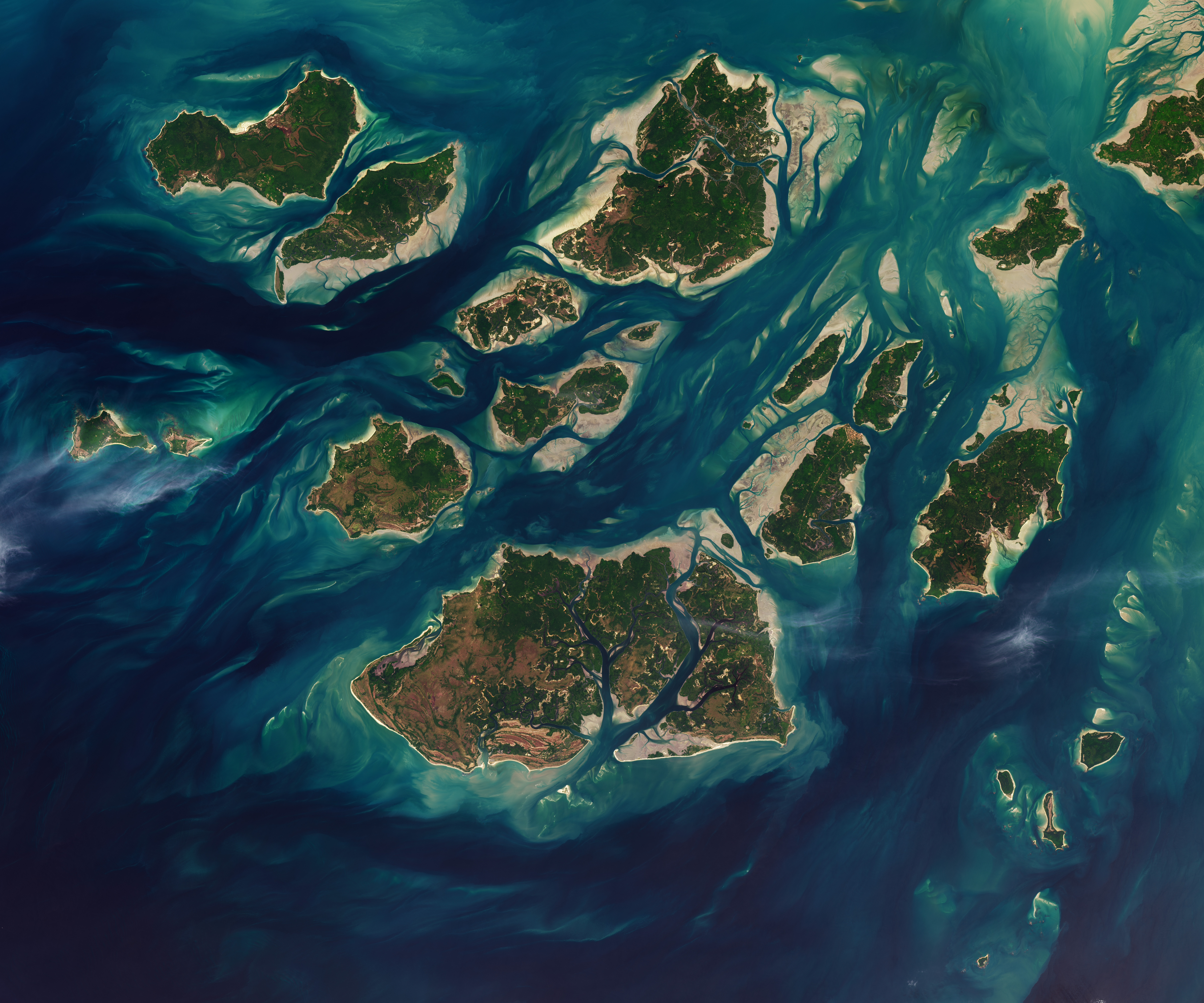
A satellite image shows a cluster of green islands surrounded by beige sand flats and networks of channels full of dark blue water.
NASA
NASA/Lauren Dauphin, USGS

Twice each day, tides ebb and flow through a maze of sandy channels, mudflats, and mangrove forests that flank the 88 islands and islets of Guinea-Bissau’s Bijagós Archipelago (Arquipélago dos Bijagós in Portuguese). Seen from above in this image from Nov. 28, 2025, the process leads to stark changes to the landscape: around low tide, intertidal mudflats and sandflats emerge from the sea, causing islands to grow significantly before shrinking again hours later.

Learn more about the region and its wildlife.

Text credit: Adam Voiland

Image credit: NASA/Lauren Dauphin, USGS

Esta notícia foi útil?

Debates 0

Seja o primeiro a contribuir com o debate.

Difunda suas informações e promova seu argumento

Não se acanhe de publicar alguma informação ou dado que possa ser positivo ou útil.

Para participar do debate, entre com sua conta ou crie uma gratuita.